Hidden relics of the past are nestled along the winding Twelvepole Creek and Tug Fork in Wayne County, West Virginia.
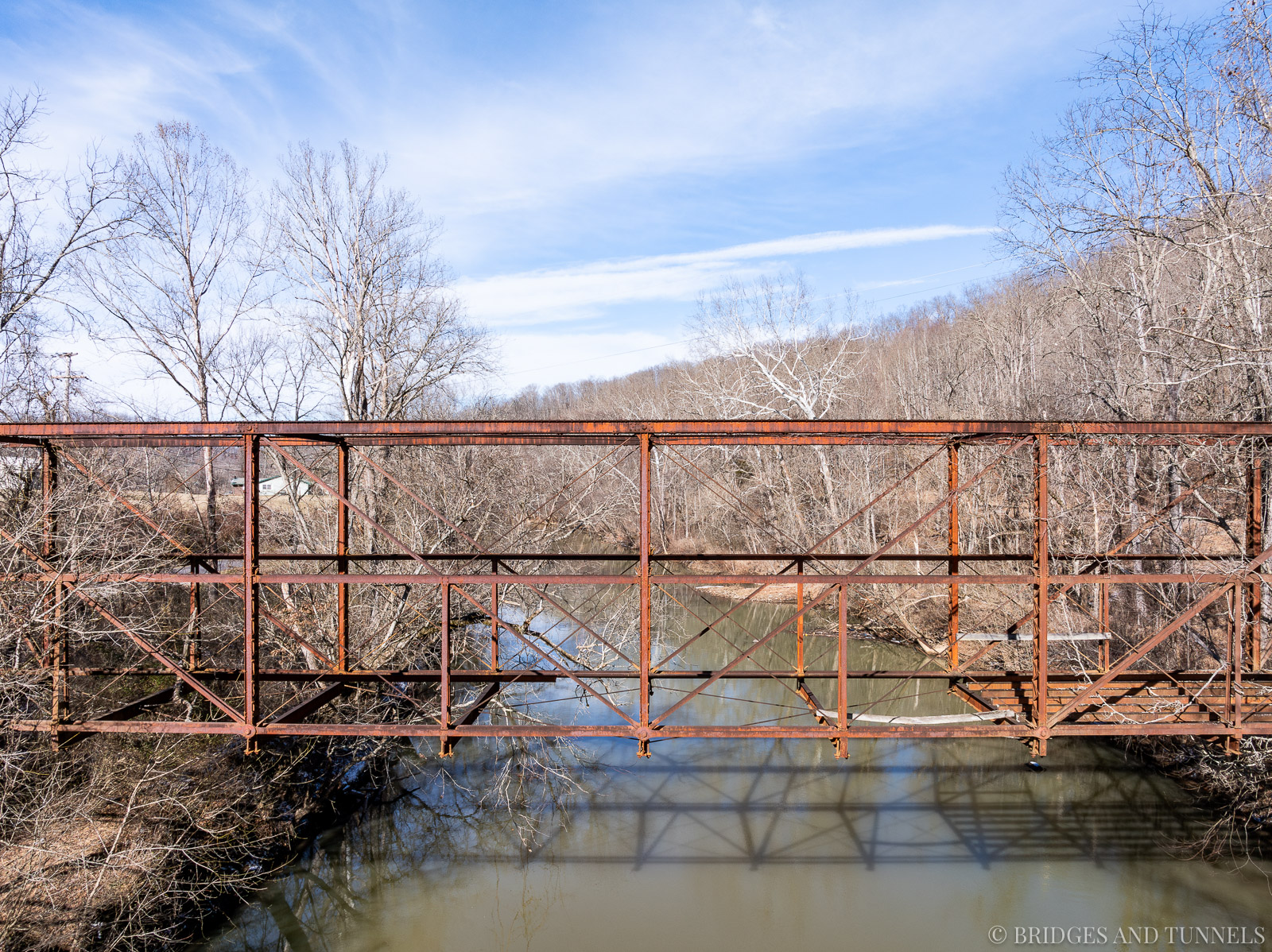
This abandoned through truss bridge, built in the late 19th century, later became part of WV Route 8. On December 5, 1930, West Virginia requested its renumbering to US Route 52, which the American Association of State Highway Officials approved on June 22, 1931.
During this transition, the State Road Commission proposed several improvement projects for WV Route 8, later US Route 52, between Lavalette and Wayne.
Project 2180, authorized in 1926, included guardrails and gravel surfacing along 10.8 miles of the route. Concrete pavement, 18 feet wide, was laid and completed by 1934. Initially, the plan called for using an existing truss bridge over Twelvepole Creek at Dickson, but in 1931, the state approved the construction of three new bridges instead.
Project 196B, authorized in October 1933, funded Bridge 1319 over Twelvepole Creek between Dickson and Pigeon Roost. Completed in 1934, this two-lane concrete and steel girder bridge replaced the Pigeon Roost Bridge.
The old Pigeon Roost Bridge was reclassified as part of County Route 52/38 (Hiram Ferguson Road), while the former alignment of US Route 52 became County Routes 52/38 and 52/39 (Camp Road). The route was abandoned between 1971 and 1983.


Further south, along the Tug Fork, several abandoned tunnels remain from the original mainline of the Ohio Extension of the Norfolk & Western Railway. Construction on the Ohio Extension began in 1889, following Elkhorn Creek, Tug Fork, and Twelvepole Creek. The first through train ran between Elkhorn and Kenova in 1891.
To accommodate growing traffic, the Big Sandy Low-Grade Line, a 59-mile single-track route along the Big Sandy River between Naugatuck and Ceredo, opened in December 1904. This line included six tunnels, with Tunnel No. 5 completed in 1906, Tunnel No. 6 in 1903, and Tunnel No. 7 in 1907.


The original Twelvepole route, later known as the Twelvepole Division, primarily handled eastbound empty coal cars, as well as local freight and passenger traffic. The Big Sandy Line was designated for westbound loaded cars and through traffic. In 1925, a second track was added to the Big Sandy Line, requiring additional bores at Tunnels No. 5 and 7, while a second track was laid alongside the Tug Fork at Tunnel No. 6.
In 1933, Norfolk & Western sought Interstate Commerce Commission approval to abandon the Twelvepole Division between Lenore and Wayne, keeping the Wayne-to-Ceredo section operational for coal shipments from East Lynn. Later, Tunnel No. 6 was bypassed, and the second bores at Tunnels No. 5 and 7 were decommissioned after the second track was removed in 1954.


The development of WV Route 8 and its transition to US Route 52 modernized central Wayne County’s roadway infrastructure, replacing aging one-lane bridges with improved routes. Similarly, the realignment of a key Norfolk & Western Railway line reflected the region’s adaptation to changing transportation needs. Though some structures, like the abandoned truss bridge and railway tunnels, have fallen into disuse, they remain as historical markers of a once-thriving network that shaped the area’s economic and industrial growth.